Checked
Halifax walking and cycling trails: all 28 city-listed routes
Halifax, Nova Scotia, Canada
Compare all 28 routes on Halifax’s regional trail page, with lengths, surfaces, trailhead references and useful access limits from official detail pages.
Key information
Compare all 28 routes on Halifax’s regional trail page, with lengths, surfaces, trailhead references and useful access limits from official detail pages.
On this page
At a glance
- Regional trail list and route planning
This directory covers every route in the city’s walking, biking and hiking trail list.
- Choose by surface, distance and access needs
The city specifically identifies Chain of Lakes, Halifax Waterfront Boardwalk and St.
- Cycling, walking and motorized use differ by route
Do not assume every listed trail allows the same activities.
Sources: Walking and hiking trails in the Halifax region · Chain of Lakes Trail official details · Shubie Park Greenway Corridor official details · Fort Sackville Walkway, Bedford / Sackville Connector Greenway official details · Mainland North Trail official details · Blueberry Run Trails official details · The Bluff Wilderness Hiking Trail official details · Musquodoboit Trailway official details
Regional trail list and route planning
This directory covers every route in the city’s walking, biking and hiking trail list. It includes trails in Bedford, Sackville, Dartmouth, Halifax, the Eastern Shore and the St. Margaret’s Bay area. Some are provincial or privately owned, while volunteer groups maintain several routes. A municipal website listing does not mean municipal ownership.
The lengths below come from individual trail pages. They can describe one linear route, a loop or an entire network. Do not add them together to estimate one journey. Point Pleasant’s 39 km is its network total; The Bluff’s 32 km covers stacked loops.
Sources: Walking and hiking trails in the Halifax region · Chain of Lakes Trail official details · Shubie Park Greenway Corridor official details · Fort Sackville Walkway, Bedford / Sackville Connector Greenway official details · Mainland North Trail official details · Blueberry Run Trails official details · The Bluff Wilderness Hiking Trail official details · Musquodoboit Trailway official details
Choose by surface, distance and access needs
The city specifically identifies Chain of Lakes, Halifax Waterfront Boardwalk and St. Margaret’s Bay Rails to Trails as wheelchair accessible. Shubie has accessible sections but not full-route access. Fort Sackville is described as not wheelchair accessible. Dingle’s elevation change is a difficult wheelchair challenge.
A surface description is not a full accessibility audit. Crusher dust, boardwalk, slopes, weather and road crossings can change a trip. Mainland North crosses main roads and school crossing guards are only present on school days. Contact the route manager for access needs that the source does not answer.
Sources: Walking and hiking trails in the Halifax region · Chain of Lakes Trail official details · Shubie Park Greenway Corridor official details · Fort Sackville Walkway, Bedford / Sackville Connector Greenway official details · Mainland North Trail official details · Blueberry Run Trails official details · The Bluff Wilderness Hiking Trail official details · Musquodoboit Trailway official details
Cycling, walking and motorized use differ by route
Do not assume every listed trail allows the same activities. Blueberry Run, Shearwater Flyer, BLT and St. Margaret’s Bay list ATV use. Blueberry Run requires off-highway registration for ATVs or off-road motorcycles. Atlantic View and Gaetz Brook describe non-motorized routes.
The Bluff uses a narrow natural surface with granite, roots and peat. It is a wilderness hiking trip, unlike a short paved waterfront walk. The Musquodoboit page separates its rail trail from neighbouring wilderness loops intended for experienced hikers.
Sources: Walking and hiking trails in the Halifax region · Chain of Lakes Trail official details · Shubie Park Greenway Corridor official details · Fort Sackville Walkway, Bedford / Sackville Connector Greenway official details · Mainland North Trail official details · Blueberry Run Trails official details · The Bluff Wilderness Hiking Trail official details · Musquodoboit Trailway official details
Using the trail maps below
Maps use source-listed trailhead references where provided. A street, park, ferry terminal or broad trail query does not guarantee the exact gate, parking bay or accessible entrance. Multiple access points are retained in the text. Route conditions and old street names need checking before travel.
The city’s time estimates vary in whether they mean one way or return. The place sections use distance and surface as the consistent comparison fields. Open the linked official detail page for the route-specific estimate and manager information.
Sources: Walking and hiking trails in the Halifax region · Chain of Lakes Trail official details · Shubie Park Greenway Corridor official details · Fort Sackville Walkway, Bedford / Sackville Connector Greenway official details · Mainland North Trail official details · Blueberry Run Trails official details · The Bluff Wilderness Hiking Trail official details · Musquodoboit Trailway official details
All 28 city-listed routes
| Trail | Source-listed length | Surface |
|---|---|---|
| DeWolf Park Boardwalk | 1 km | Wooden boardwalk |
| First Lake Glen Slauenwhite Trail | 3.3 km | Crusher dust and sidewalk |
| Fort Sackville Walkway, Bedford / Sackville Connector Greenway | 6 km | Crusher dust |
| Sackville Lakes Park and Trails | 5.3 km | Crusher dust |
| Atlantic View Trail | 10 km | Crusher dust or fine gravel |
| Blueberry Run Trails | 12.8 km | Crusher dust or fine gravel |
| Cole Harbour Heritage Park | 9 km | Crusher dust; wood chips on minor trails |
| Crowbar Lake Hiking Trail | 18 km | Natural forest surface |
| Gaetz Brook Greenway | 6.8 km | Crusher dust or fine gravel |
| Musquodoboit Trailway | 15 km | Crusher dust |
| Salt Marsh Trail | 6.5 km | Crusher dust |
| Shearwater Flyer Trail | 8 km | Crusher dust |
| Dartmouth Harbourfront Walkway | 3 km | Pavement |
| Portland Lakes Greenway | 2.2 km | Crusher dust |
| Shubie Park Greenway Corridor | 9.25 km | Crusher dust and pavement |
| Barrington Street Active Transportation Greenway | 800 m | Asphalt |
| Chain of Lakes Trail | 7.25 km | Crusher dust and asphalt |
| Frog Pond Trail | 1.4 km | Crusher dust |
| Halifax Common Link Trail | Not stated | Urban connecting paths |
| Halifax Urban Greenway | 1 km | Asphalt |
| Halifax Waterfront Boardwalk | 3.8 km | Wooden boardwalk and pavement |
| Mainland North Trail | 4.5 km | Crusher dust |
| McIntosh Run Community Trail | 1.3 km | Crusher dust |
| Point Pleasant Park Trails | 39 km network; 3.36 km perimeter loop | Crusher dust, wood chips and paved sections |
| Sir Sandford Fleming Park Trail | 2.8 km | Crusher dust and paved sections |
| Beechville, Lakeside, Timberlea Trail | 13 km | Crusher dust |
| St Margaret’s Bay Rails to Trails | 32 km | Crusher dust |
| The Bluff Wilderness Hiking Trail | 32 km network | Narrow, irregular granite, roots and peat |
Trail details and access points
DeWolf Park Boardwalk
End of Convoy Way, Bedford, Halifax Regional Municipality, Nova Scotia, Canada
A linear waterfront route with benches, picnic tables, parking and washrooms. The city gives an estimated 15-minute visit.
- Source-listed length
- 1 km
- Surface
- Wooden boardwalk
First Lake Glen Slauenwhite Trail
First Lake Drive and Glendale Drive, Lower Sackville, Halifax Regional Municipality, Nova Scotia, Canada
A linear trail with boardwalk sections, benches and parking. The city lists links to the Second Lake trail system.
- Source-listed length
- 3.3 km
- Surface
- Crusher dust and sidewalk
Sources: First Lake Glen Slauenwhite Trail official trail details
Fort Sackville Walkway, Bedford / Sackville Connector Greenway
Scott Manor House, Bedford; Fultz House, Lower Sackville, Halifax Regional Municipality, Nova Scotia, Canada
A linear route with access from Fish Hatchery Park, Bedford Place Mall and Range Park. The city states that this trail is not wheelchair accessible.
- Source-listed length
- 6 km
- Surface
- Crusher dust
Sources: Fort Sackville Walkway, Bedford / Sackville Connector Greenway official trail details
Sackville Lakes Park and Trails
440 First Lake Drive, Lower Sackville, Halifax Regional Municipality, Nova Scotia, Canada
A provincially owned linear route with washrooms, benches and parking. The listed estimate is 1.5 hours one way.
- Source-listed length
- 5.3 km
- Surface
- Crusher dust
Sources: Sackville Lakes Park and Trails official trail details
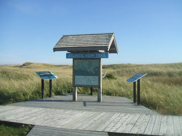
Atlantic View Trail
Lawrencetown Beach, Lawrencetown, Halifax Regional Municipality, Nova Scotia, Canada
A linear rail trail with washrooms, picnic shelters, benches and parking. It connects to Salt Marsh Trail at its west end.
- Source-listed length
- 10 km
- Surface
- Crusher dust or fine gravel
Blueberry Run Trails
459 East Chezzetcook Road, West Chezzetcook, Halifax Regional Municipality, Nova Scotia, Canada
A linear trail interrupted by Highway 107. It has two accessible picnic shelters and permits registered off-highway vehicles. Other listed access points are Grand Desert Station Road and 5909 Highway 207.
- Source-listed length
- 12.8 km
- Surface
- Crusher dust or fine gravel
Cole Harbour Heritage Park
256 Bissett Road, Cole Harbour, Halifax Regional Municipality, Nova Scotia, Canada
A loop network with washrooms, picnic shelters, boardwalk and parking. Route choice changes the time needed.
- Source-listed length
- 9 km
- Surface
- Crusher dust; wood chips on minor trails
Crowbar Lake Hiking Trail
1800 Myra Road, Porters Lake, Halifax Regional Municipality, Nova Scotia, Canada
Various hiking loops with a parking lot. The city gives a wide two-to-ten-hour estimate, so choose a specific loop before leaving.
- Source-listed length
- 18 km
- Surface
- Natural forest surface
Gaetz Brook Greenway
24 Debras Way, East Chezzetcook, Halifax Regional Municipality, Nova Scotia, Canada
A linear non-motorized rail trail with two accessible washrooms and an accessible picnic shelter. Other parking points are 6644 Highway 7, 6856 Highway 7 and 7422 Highway 7.
- Source-listed length
- 6.8 km
- Surface
- Crusher dust or fine gravel
Musquodoboit Trailway
Musquodoboit Railway Museum, Highway 7, Musquodoboit Harbour, Halifax Regional Municipality, Nova Scotia, Canada
A linear trail with washrooms, shelters and parking. Adjacent Granite Ridge, Gibraltar Rock, Admiral Lake and Bayer Lake wilderness routes are for experienced hikers. Other access is at Park Road and Highway 357 near Gibraltar Rock.
- Source-listed length
- 15 km
- Surface
- Crusher dust
Salt Marsh Trail
Salt Marsh Trail, Cole Harbour, Halifax Regional Municipality, Nova Scotia, Canada
A linear rail trail with washrooms, benches and parking. Connections include Atlantic View, Shearwater Flyer and Cole Harbour Heritage Park. The detail page does not identify a street entrance.
- Source-listed length
- 6.5 km
- Surface
- Crusher dust
Shearwater Flyer Trail
Bissett Road to Corsair Avenue, Cole Harbour, Halifax Regional Municipality, Nova Scotia, Canada
A linear rail trail with benches, parking and kilometre markers. The city lists walking, cycling, skiing and ATV use.
- Source-listed length
- 8 km
- Surface
- Crusher dust
Dartmouth Harbourfront Walkway
Woodside Ferry Terminal and Dartmouth Ferry Terminal, Dartmouth, Halifax Regional Municipality, Nova Scotia, Canada
A linear harbour route between ferry-terminal access points. It has washrooms, benches, parking and boardwalk sections.
- Source-listed length
- 3 km
- Surface
- Pavement
Sources: Dartmouth Harbourfront Walkway official trail details
Portland Lakes Greenway
Baker Drive at Norman Newman Drive, Dartmouth, Halifax Regional Municipality, Nova Scotia, Canada
A linear route with boardwalk and picnic shelters. Other access is between the Portland Hills Drive soccer fields and at Birches Park on Portland Estates Boulevard.
- Source-listed length
- 2.2 km
- Surface
- Crusher dust
Shubie Park Greenway Corridor
Fairbanks Centre, 54 Lock Road, Dartmouth, Halifax Regional Municipality, Nova Scotia, Canada
A linear greenway with benches, picnic tables and parking. Some sections are wheelchair accessible; others are not. Washrooms are listed Monday to Friday.
- Source-listed length
- 9.25 km
- Surface
- Crusher dust and pavement
Sources: Shubie Park Greenway Corridor official trail details
Barrington Street Active Transportation Greenway
Barrington Street at North Street, Halifax, Halifax Regional Municipality, Nova Scotia, Canada
A short linear walking and cycling link. The source also names the Barrington and Cornwallis intersection as an access point using its older street name.
- Source-listed length
- 800 m
- Surface
- Asphalt
Sources: Barrington Street Active Transportation Greenway official trail details
Chain of Lakes Trail
Joseph Howe Drive across from the Superstore, Halifax, Halifax Regional Municipality, Nova Scotia, Canada
A wheelchair-accessible linear rail trail through Bayers Lake Business Park to Lakeside Business Park. It links to the Beechville Lakeside Timberlea Trail.
- Source-listed length
- 7.25 km
- Surface
- Crusher dust and asphalt
Frog Pond Trail
Purcell’s Cove Road, near Dingle Road, Halifax, Halifax Regional Municipality, Nova Scotia, Canada
A loop with boardwalk, benches, picnic tables and parking. The city locates the trailhead 2.2 km after the Herring Cove Road and Purcell’s Cove Road intersection. It connects to Dingle trails via Dingle Road.
- Source-listed length
- 1.4 km
- Surface
- Crusher dust
Halifax Common Link Trail
Halifax Common, Halifax, Halifax Regional Municipality, Nova Scotia, Canada
A walking network linking Victoria Park, Public Gardens, Citadel, North Common and Camp Hill Cemetery. It uses wayfinding street decals; the source does not give a single trailhead or total length.
- Source-listed length
- Not stated
- Surface
- Urban connecting paths
Halifax Urban Greenway
Beaufort Avenue area, Halifax, Halifax Regional Municipality, Nova Scotia, Canada
A linear multi-use route beside the CN rail corridor. The city lists walking, cycling, skiing and birdwatching, with a 15-minute one-way estimate. A precise entrance is not given.
- Source-listed length
- 1 km
- Surface
- Asphalt
Halifax Waterfront Boardwalk
Upper and Lower Water Streets, Halifax, Halifax Regional Municipality, Nova Scotia, Canada
A wheelchair-accessible linear waterfront route from Pier 21 near Marginal and Terminal Roads to Casino Nova Scotia. Multiple access points serve the boardwalk.
- Source-listed length
- 3.8 km
- Surface
- Wooden boardwalk and pavement
Sources: Halifax Waterfront Boardwalk official trail details
Mainland North Trail
Parkland Drive, Westridge Drive and Main Avenue, Halifax, Halifax Regional Municipality, Nova Scotia, Canada
A linear trail crossing several main roads. School crossing guards are present only on school days. Parking is near access points, except Lacewood Drive.
- Source-listed length
- 4.5 km
- Surface
- Crusher dust
McIntosh Run Community Trail
North end of River Road, Spryfield, Halifax Regional Municipality, Nova Scotia, Canada
A linear community route with parking. A footbridge at the north end links to a paved trail through Silver Estates. This is not the entire wider McIntosh Run trail network.
- Source-listed length
- 1.3 km
- Surface
- Crusher dust
Sources: McIntosh Run Community Trail official trail details
Point Pleasant Park Trails
End of Point Pleasant Drive and Tower Road, Halifax, Halifax Regional Municipality, Nova Scotia, Canada
A year-round park network with washrooms, shelters, picnic tables and parking. Network length is not the length of one walk.
- Source-listed length
- 39 km network; 3.36 km perimeter loop
- Surface
- Crusher dust, wood chips and paved sections
Sir Sandford Fleming Park Trail
Dingle Tower parking lot and lower boat-launch parking lot, Halifax, Halifax Regional Municipality, Nova Scotia, Canada
Park trails connect to Frog Pond via Dingle Road. The climb from waterfront to loop is a difficult wheelchair challenge. Dingle Tower’s stated season is May 1 to October 31.
- Source-listed length
- 2.8 km
- Surface
- Crusher dust and paved sections
Sources: Sir Sandford Fleming Park Trail official trail details
Beechville, Lakeside, Timberlea Trail
Beechville Park Drive, Beechville Industrial Park, Halifax Regional Municipality, Nova Scotia, Canada
A linear rail trail with parking, benches and kilometre markers. It connects to The Bluff near kilometre 7 and St. Margaret’s Bay Trail at kilometre 13. ATVs are among its listed uses.
- Source-listed length
- 13 km
- Surface
- Crusher dust
Sources: Beechville, Lakeside, Timberlea Trail official trail details
St Margaret’s Bay Rails to Trails
Station Road, Hubbards; Station Road, Head of St. Margaret’s Bay; Highway 3, Hubley, Halifax Regional Municipality, Nova Scotia, Canada
A linear wheelchair-accessible rail trail with three source-listed trailhead areas. It joins the BLT Trail and Chester Connector. ATVs are among the listed uses.
- Source-listed length
- 32 km
- Surface
- Crusher dust
Sources: St Margaret’s Bay Rails to Trails official trail details
The Bluff Wilderness Hiking Trail
2890 St. Margaret’s Bay Road, Timberlea, Halifax Regional Municipality, Nova Scotia, Canada
Four stacked wilderness loops. From the parking lot, follow BLT Trail west for 0.7 km to the trailhead. Allow three to six hours per loop plus connecting access time.
- Source-listed length
- 32 km network
- Surface
- Narrow, irregular granite, roots and peat
Sources: The Bluff Wilderness Hiking Trail official trail details
Questions and answers
How many trails does this directory cover?
All 28 entries in the municipality’s regional walking, biking and hiking list, with a separate official detail source for each.
Are all these trails owned by Halifax?
No. The list includes municipal, provincial and privately owned land. Community groups maintain some routes.
Which short waterfront walk is listed in Bedford?
DeWolf Park Boardwalk is listed as a one-kilometre wooden boardwalk with access at the end of Convoy Way.
Which trail connects Joseph Howe Drive to Lakeside?
Chain of Lakes Trail. The city lists 7.25 km, connecting through Bayers Lake to the BLT Trail.
Does 39 km at Point Pleasant mean one loop?
No. It is the network total. The city separately lists a 3.36 km perimeter loop.
Is The Bluff a paved urban walk?
No. It has narrow, uneven natural surfaces and four stacked wilderness loops. Allow route-specific hiking time and connecting access time.
Can I assume every greenway bans ATVs?
No. Blueberry Run, Shearwater Flyer, BLT and St. Margaret’s Bay list ATV use. Check each route’s rules.
Is all of Shubie Canal Greenway wheelchair accessible?
No. The city says some sections are accessible, but not all.
Where are Gaetz Brook Greenway’s parking points?
The detail page lists 24 Debras Way, 6644 Highway 7, 6856 Highway 7 and 7422 Highway 7.
Why do map points sometimes show a broad area?
Some source pages give only a street, trail name or general access reference. The guide does not invent precise visitor entrances.
Official sources and next steps
- Walking and hiking trails in the Halifax region
- Chain of Lakes Trail official details
- Shubie Park Greenway Corridor official details
- Fort Sackville Walkway, Bedford / Sackville Connector Greenway official details
- Mainland North Trail official details
- Blueberry Run Trails official details
- The Bluff Wilderness Hiking Trail official details
- Musquodoboit Trailway official details
Sources: Walking and hiking trails in the Halifax region · Chain of Lakes Trail official details · Shubie Park Greenway Corridor official details · Fort Sackville Walkway, Bedford / Sackville Connector Greenway official details · Mainland North Trail official details · Blueberry Run Trails official details · The Bluff Wilderness Hiking Trail official details · Musquodoboit Trailway official details